CLICK TO REVIEW 2023 VOLUNTEER TRIPS
2023 volunteer opportunities
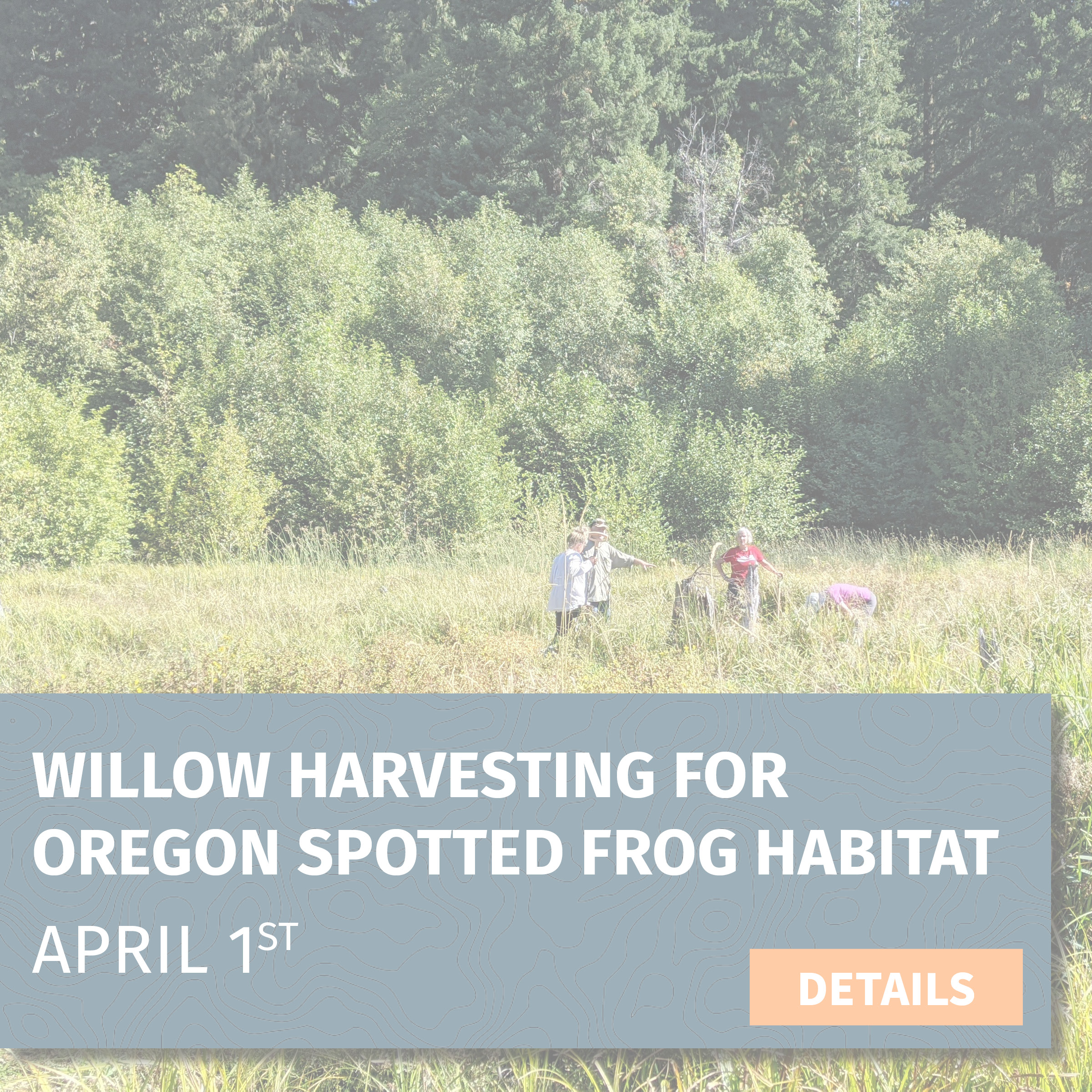
Willow Harvesting for Oregon Spotted Frog Habitat
Project: Willow Harvesting for Oregon Spotted Frog Habitat
Date: April 1 (Saturday, 10:00 am-4:00 pm)
Location: Trout Lake Creek, WA (2 hours from PDX/Vancouver)
Trip leader: Amanda Keasberry
Trip description: We'll be harvesting 1,500 dormant willow stems that will later be planted in a habitat complex for the Oregon spotted frog that the U.S. Forest Service has been working to restore for several years. The Oregon spotted frog is listed under the Endangered Species Act as threatened, and the population at this project site is one of few in the state.
Botany specialists from the Forest Service will be present to provide background information on the frog's life history and our shared conservation goals. The stems we collect will be moved to a Forest Service cooler so they can maintain their dormancy until we can plant them once the snow melts enough for us to be able to access the planting site.
Task: Cutting willow stems with loppers and clippers
Trip difficulty: 3 out of 5 || This trip includes using hand tools, continual bending and squatting and walking on uneven terrain with heavy gear. Volunteers are encouraged to work at a pace that is most comfortable for them.
What you need: Sturdy hiking boots, warm layers, rain gear, sun protection, day pack with food/water and other essentials, and camping gear (detailed list sent via email)
Gear provided: Rubber boots, waders, loppers, clippers, gloves
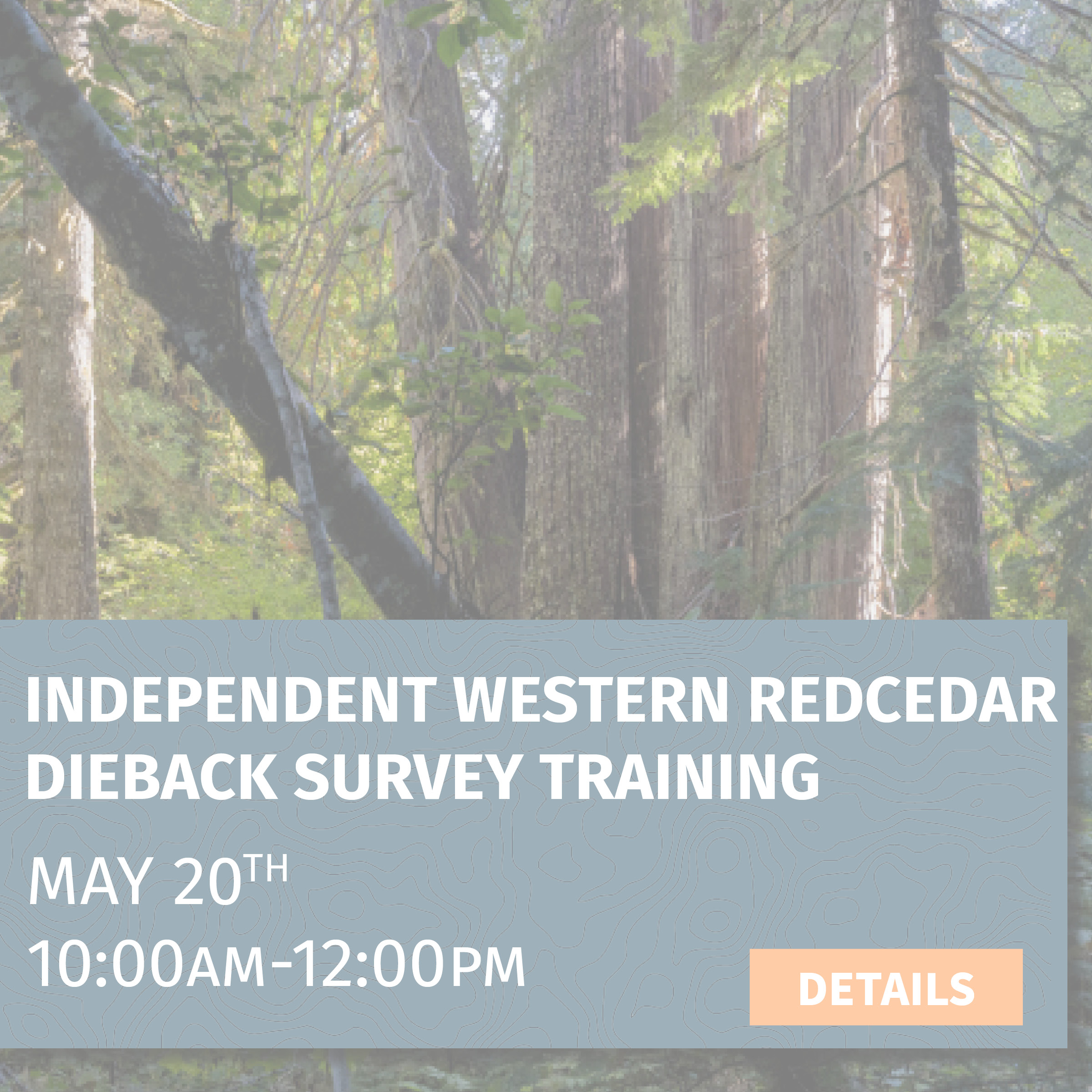
Independent Western Redcedar Dieback Study Training
Project: Independent Western Redcedar Dieback Study Training
Date: May 20, 2023 10:00am–12:00pm
Location: Mt. Tabor, Portland, OR
Training leader: Amanda Keasberry
Project description: Western redcedar is critical to the livelihood of our forests and communities. However, many reports of dieback have been documented recently. Washington State University and Oregon State University researchers urgently need help understanding why! They have launched a community science project to try to collect as much data as possible to understand what is causing western redcedar dieback. There is a lack of data about western redcedars in SW Washington, so we will be providing materials and training to empower our volunteers to help these iconic trees by collecting data for this project while enjoying the beautiful southern Washington Cascades.
During this training, you will learn about western redcedar identification and ecology, equipment checklist, safety procedures, and volunteer guidelines. The surveys will be completed independently by volunteers on their own time.
This is the perfect opportunity for people who want to be involved in conservation projects in the Cascades but can’t join us for our weekend trips.
Trip difficulty: Surveys will involve as much hiking as you desire.
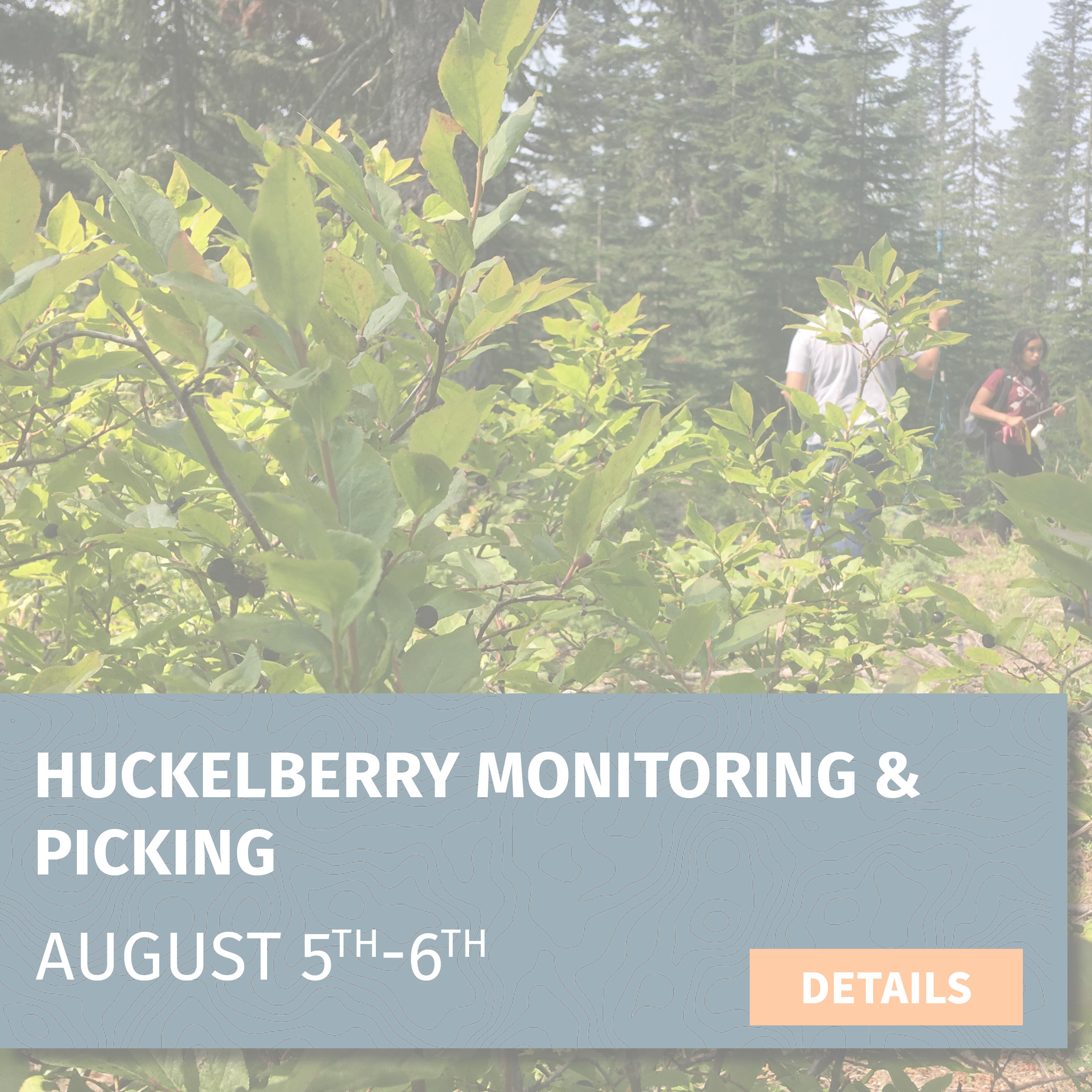
Huckleberry Monitoring & Picking
Project: Huckleberry Monitoring & Picking
Date: August 5-6, 2023 (10:00 am Saturday - 3:00 pm Sunday)
Location: Sawtooth Berry Fields (2 hours from PDX/Vancouver)
Trip leader: Deb Goldberg
Trip description: Through our involvement with the Pinchot Partners forest collaborative, we are continuing to monitor huckleberry sites to determine the effects of forest thinning on huckleberry growth. On the first day, volunteers will receive on-site training and will then split into groups to collect data either within forest stands that are set to be thinned for huckleberry restoration in the near future or at sites previously surveyed to collect follow-up data. On day two, we’ll return to the huckleberry fields to visit more plots before spending the remainder of the day picking huckleberries (participants must obtain a free Forest Products Permit). Join us to learn all about huckleberries and their cultural and ecological importance!
Task: Data collection and huckleberry picking
Trip difficulty: 4 out of 5 || This trip will entail hiking on uneven ground, through brush, and over downed logs. Trees are limited in this area, so there will be extended periods of sun exposure.
What you need: Sturdy hiking boots, warm layers, rain gear, sun protection, day pack with food/water and other essentials, camping gear (detailed list sent via email), huckleberry permit https://apps.fs.usda.gov/gp/#mainSection, gallon container for huckleberries
Gear provided: Data collection equipment
Lodging: Campground near Indian Heaven Wilderness
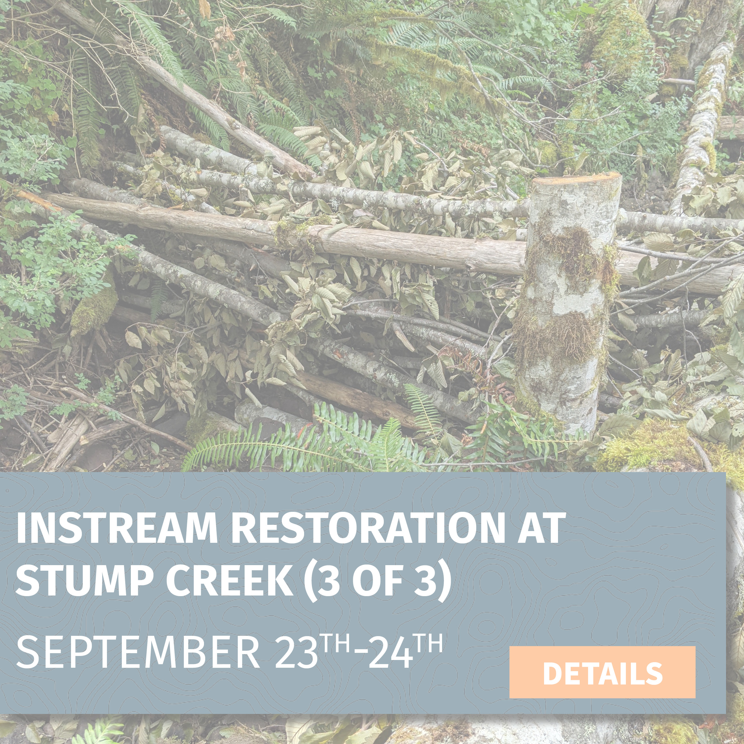
Instream Restoration at Stump Creek #3
Project: Instream Restoration at Stump Creek #3
Date: NEW DATE September 23-24, 2023 (10:00 am Saturday - 2:00 pm Sunday)
Location: Stump Creek, in the upper reaches of the South Fork Toutle River (2.5 hours from PDX/Vancouver)
Trip leader: Shiloh Halsey
Trip description: Trip description: On this trip, we will be working to improve instream habitat along a waterway called Stump Creek, which flows into the South Fork Toutle River just west of Mount St. Helens. Volunteers will learn to use “low-tech restoration” techniques to build small instream wood structures using sustainably-sourced trees and branches. These structures will increase stream complexity, attenuate flows, and create deep pools—all of which are habitat improvements that will benefit salmonids and Pacific lamprey!
In addition to the direct benefits we hope to see, these kinds of projects are also intended to help beavers re-establish themselves in these landscapes by creating anchor points that will attract them and offer protection from predation (deep pools and new side-channels). This will help them establish local populations so that their presence can extend the positive aquatic impacts far into the future.
Task: Using handsaws, loppers, and clippers to gather natural material and then strategically placing them in the stream (during and before the placement of larger wood pieces)
Trip difficulty: 5 out of 5 || This trip entails full days of physical labor near and in creeks and ponds. Getting into shallow water will be required for this trip. Volunteers are encouraged to work at a comfortable pace
What you need: Sturdy hiking boots, warm layers, rain gear, sun protection, day pack with food/water and other essentials, and camping gear (detailed list sent via email)
Gear provided: Hand tools, gloves, rubber boots, waders, safety glasses, hard hats
Lodging: Dispersed camping at project site
Instream Restoration at Stump Creek #2
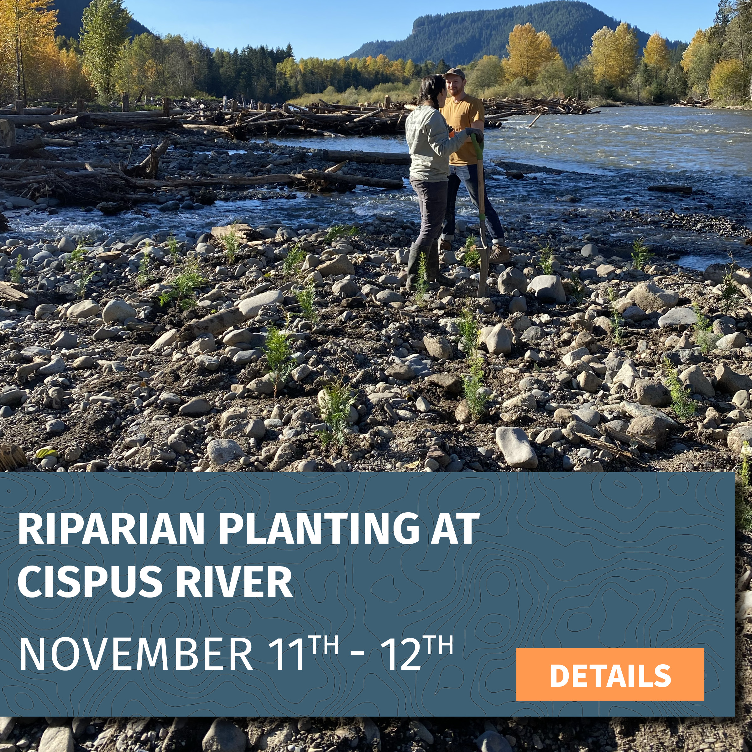
Project: Riparian Planting at Cispus River
Date: November 11–12, 2023 (10:30 am Saturday - 3:00 pm Sunday)
Location: Cispus River/Yellowjacket Creek confluence (2.5 hours from PDX/Vancouver)
Trip leader: Amanda Keasberry
Trip description: We’ve planted over 7,000 Douglas firs and western redcedars at the Cispus/Yellowjacket inseam restoration site. To enhance biodiversity in the areas we already planted, we want to fill the area with willow and cottonwood. Conveniently, cottonwood and willow branches can be cut and placed stakes straight into the ground. For this trip, we will harvest cottonwood and willow on-site using loppers and clippers. This project is in partnership with Cowlitz Indian Tribe and the Forest Service, and the overall goals are to restore and improve the habitat for juvenile coho, winter steelhead, and spring Chinook salmon at the confluence of the Cispus River and Yellowjacket Creek.
Task: Using loppers and clippers to harvest cottonwood and willow and then staking them into the ground
Trip difficulty:4 out of 5 || Must be comfortable wading through streams ranging from ankle- to waist-deep. Walking to the project site involves walking over uneven terrain, including large cobbles.
What you need: Waders, warm layers, rain gear, sun protection, day pack with food/water and other essentials (detailed list sent via email)
Gear provided: Gloves, orange vests, loppers and clippers
Lodging: Cispus Learning Center
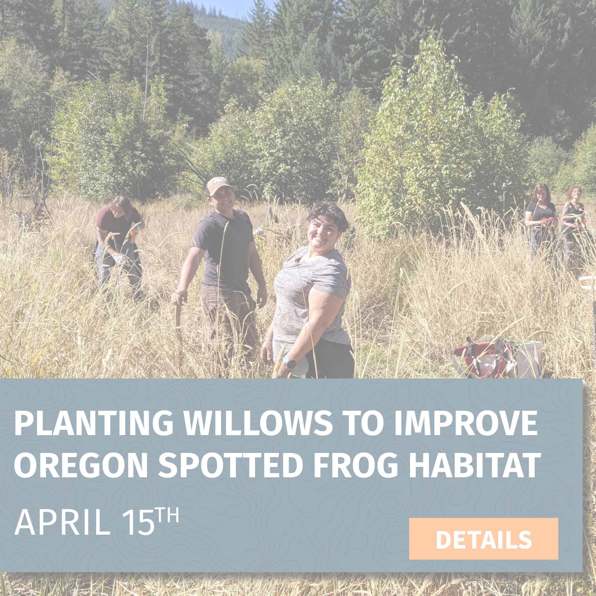
Planting Willows To Improve Oregon Spotted Frog Habitat
Project: Planting Willows To Improve Oregon Spotted Frog Habitat
Date: April 15 (Saturday, 10:00 am-4:00 pm)
Location: Trout Lake Creek, near Trout Lake, WA (2 hours from PDX/Vancouver)
Trip leader: Amanda Keasberry
Trip description: We'll be planting the 1,500 willow stems that were harvested earlier in the month into a habitat complex that the U.S. Forest Service has been working to restore habitat for the Oregon spotted frog, a species listed as threatened under the Endangered Species Act. Botany specialists from the Forest Service will be present to provide background information on the species' life history and conservation goals. We will focus on reinforcing a beaver dam analog that was built to help hold water in the system for longer periods. We will also be planting in adjacent areas to enhance the overall biodiversity of this wetland habitat.
Task: Staking willows in wetland habitat.
Trip difficulty: 3 out of 5 || This trip includes continual bending, squatting, and walking on uneven terrain with heavy gear. Volunteers are encouraged to work at a pace that is most comfortable for them.
What you need: Sturdy hiking boots, warm layers, rain gear, sun protection, day pack with food/water and other essentials, and camping gear (detailed list sent via email)
Gear provided: Rubber boots, gloves, planting bags
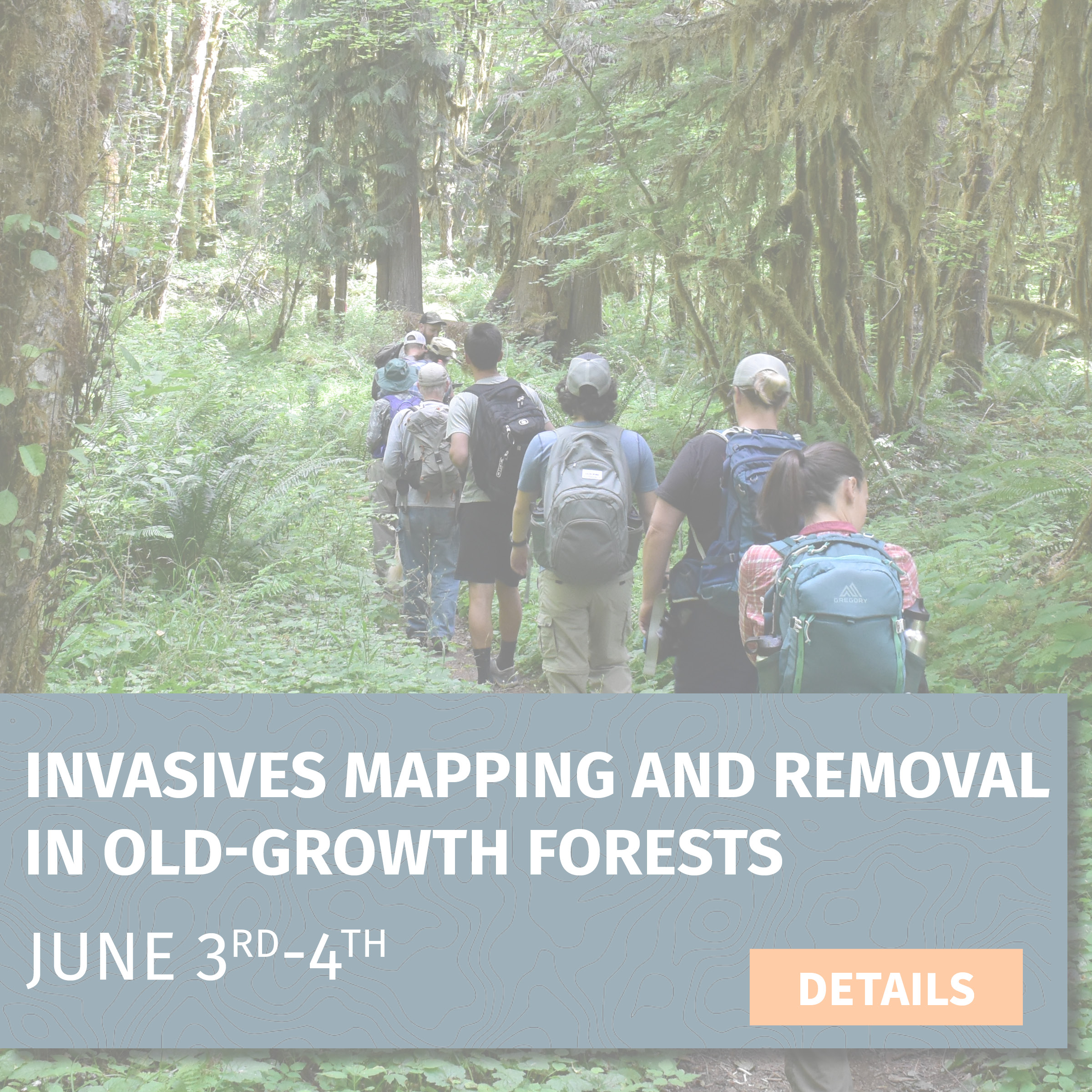
Invasives Mapping and Removal in Old-Growth Forests
Project: Invasives Mapping and Removal in Old-Growth Forests
Date: June 3-4, 2023 (10:00 am Saturday - 3:00 pm Sunday)
Location: Lewis River Trail near Curly Creek Falls, (2 hours from PDX/Vancouver)
Trip leader: Suzanne Whitney
Trip description: Locations of the invasive plant species herb Robert have been identified in stands of old-growth along the Lewis River. Herb Robert’s tolerance to shady understories and its threat to mature forest ecosystems make it an invasive species of particular concern to CFC.
Join us on this two-day trip where we will visit a few areas of old-growth forest in and around the Lewis River valley. In addition to removing herb Robert, you will also be helping to map the area using GIS. This will help CFC and the Forest Service monitor future locations to ensure the plants haven’t reinvaded the area.
Task: Hand-pulling invasive species along a trail and mapping removal locations on an iPad.
Trip difficulty: 3 out of 5 || This trip will entail walking 3+ miles on a trail that is rated moderate. On occasion, you will be going off-trail and potentially walking over downed logs and through brush. This activity also requires a lot of continual bending and squatting.
What you need: Sturdy hiking boots, warm layers, rain gear, sun protection, day pack with food/water and other essentials, and camping gear (detailed list sent via email)
Gear provided: Gloves, trash bags
Lodging: Developed campground near the Lewis River
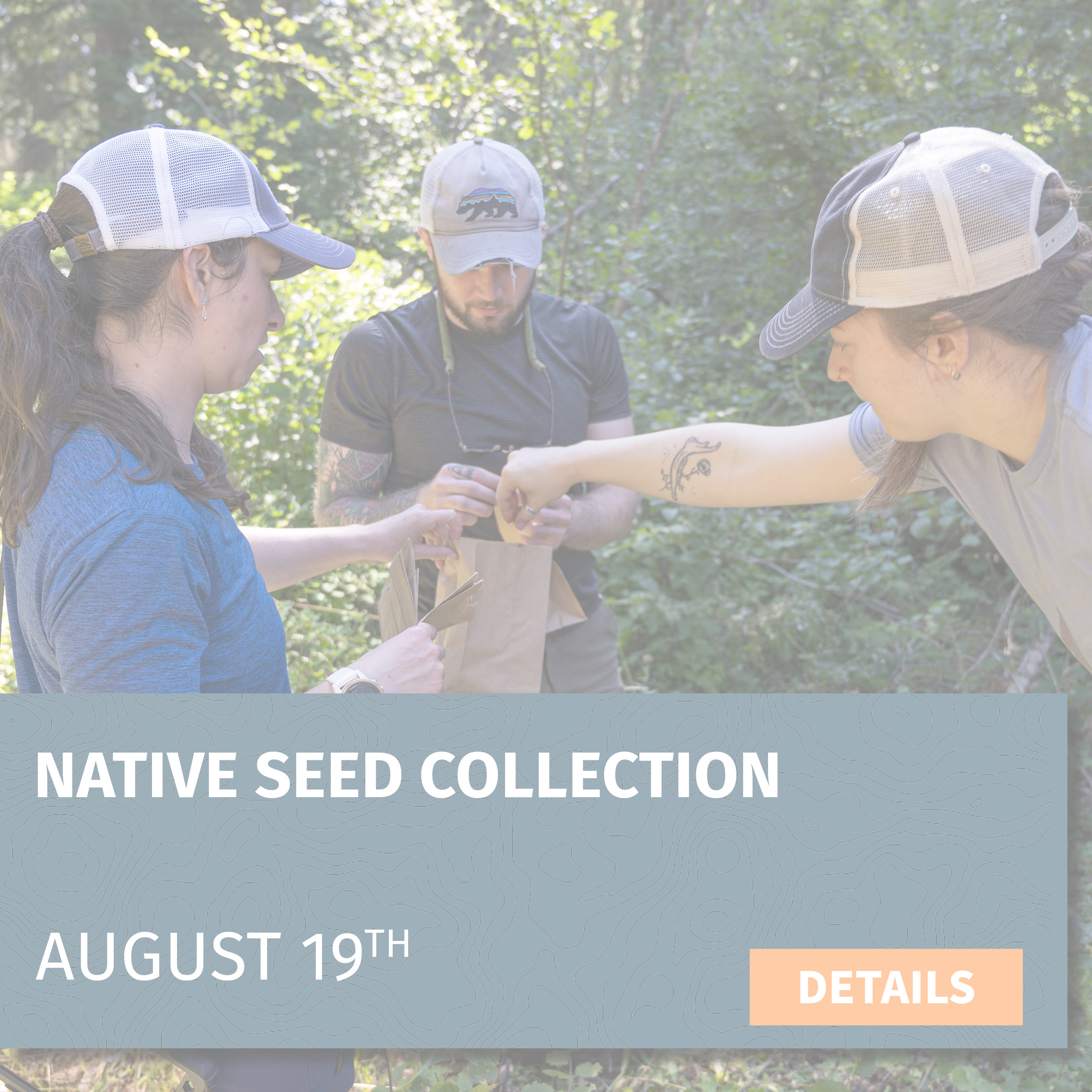
Native Seed Collection
Project: Native Seed Collection
Date: August 19, 2023 (Saturday 10:00am-4:00pm)
Location: Gifford Pinchot National Forest south of Mount Adams
Trip leader: Deb Goldberg
Trip description: Join us to collect native shrub and wildflower seeds that will contribute to our long-term effort to increase biodiversity in the post-fire habitats around Mount Adams. The seeds will be used for restoration in forest stands severely impacted by uncharacteristically intense and recurrent fires. Volunteers will be trained by a U.S. Forest Service botany specialist on the identification and benefits of various native species. Some of the seeds we collect on this trip will be sown directly on the burned landscape this fall, while others will be sent to a Forest Service facility to be grown out for planting in the future. Help us gather seeds while also learning to identify over 20 native plants found in the Gifford Pinchot National Forest!
Task: Learning native plant identification and collecting seeds
Trip difficulty: 2 out of 5 || The trip requires walking along uneven ground and extended exposure to the sun. This activity also requires a lot of continual bending and squatting
What you need: Sturdy hiking boots, warm layers, rain gear, sun protection, day pack for food/water and other essentials
Gear provided: Gloves, bags for gathering seed
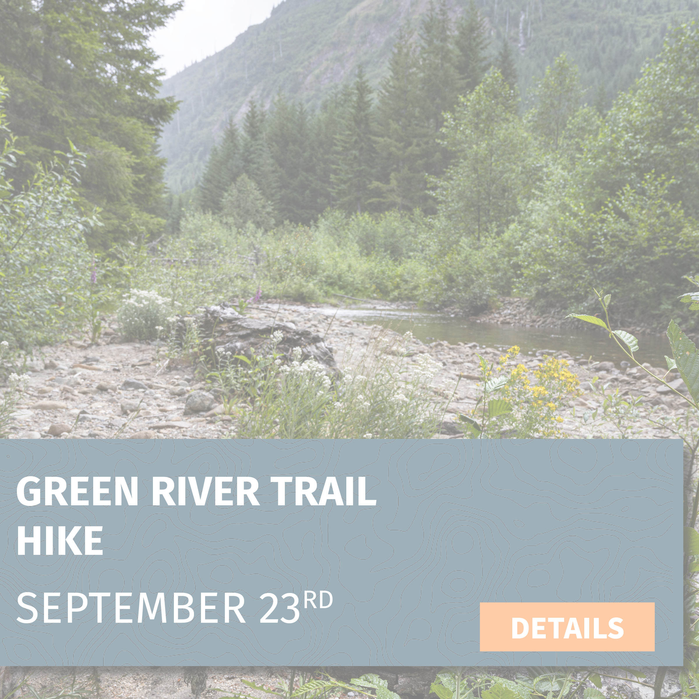
Green River Trail Hike
Project: Hiking the Green River Trail
Date: September 23, 2023 (Saturday 10:00am-4:00pm)
Location: Meet at the Cowlitz Valley Ranger Station (2 hours from PDX/Vancouver)
Trip leader: Sean Roome & Ashley Short
Trip description: We will be hiking the first 3 miles (6 miles total, including the return trip) of the Green River Trail, which is a fairly flat and easy walk through the Green River Valley along the beautiful Green River. Once we get to the trailhead, we will start our trip with a short introduction and history of our efforts to prevent a mine in this site, and then make our way down the trail. At the turnaround point, we will have lunch and chat about our campaign to protect this place in perpetuity before making our way back to the trailhead.
Task: Hike 4 miles along the Green River Trail in the Gifford Pinchot National Forest
Trip difficulty: 2 out of 5 || This trip entails walking on trail over relatively flat ground.
What you need: Sturdy hiking boots, warm layers, rain gear, sun protection, day pack with food/water and other essentials (detailed list sent via email)
Gear provided: N/A
Lodging: N/A
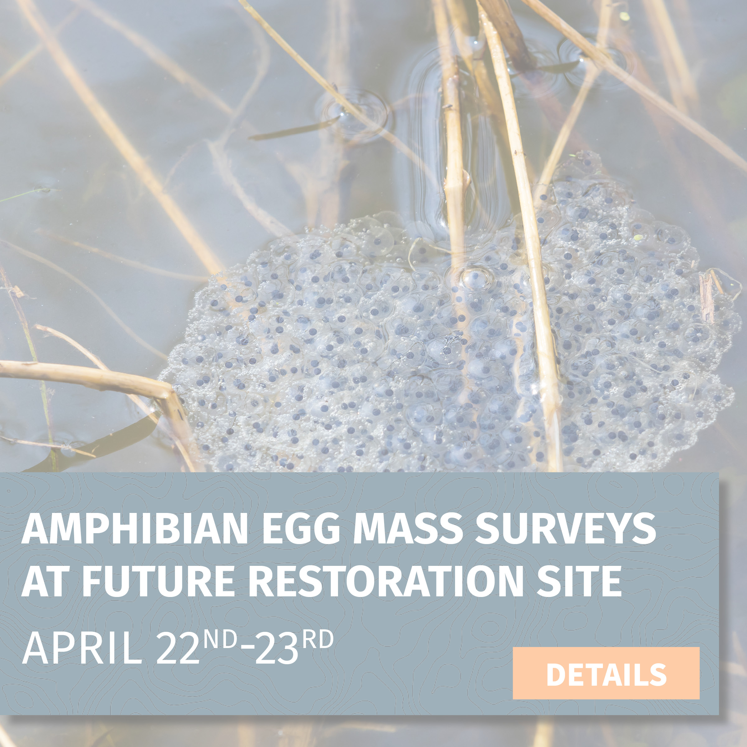
Amphibian Egg Mass Surveys at Future Restoration Site
Project: Amphibian Egg Mass Surveys at Future Restoration Site
Date: April 22-23, 2023 (Saturday - Sunday)
Location: Tributaries of the Cispus River, near Randle, WA (2.5 hours from PDX/Vancouver)
Training leader: Amanda Keasberry
Project description:
Amphibians rely on both aquatic and terrestrial landscapes to breed and live. Instream restoration has the potential to benefit amphibian populations, and we are setting out to collect field data to help answer questions about the role that our restoration projects can play in improving the health and resilience of amphibians. We will be visiting the sites of future aquatic restoration projects where woody debris will be added to the water to create habitat complexity. This addition of wood should keep water in the system for longer, create deeper pools, and form new side channels and wetlands, all of which are changes that can make new habitat for frog and salamander species. We will survey several project sites for egg masses to see what amphibian species are breeding in these areas. After the restoration project is complete in the following years, we will revisit the site to see how amphibians responded to the work. A WSU graduate student will be joining us to teach us amphibian identification and methods for conducting egg mass surveys. This will be an enjoyable learning experience for all!
Task: Searching streams and wetland areas for frogs and salamanders
Trip difficulty: 4 out of 5 || This trip entails walking in and around creeks and ponds. Getting into shallow water will be required for this trip. Volunteers are encouraged to work at a comfortable pace.
What you need: Sturdy hiking boots (rubber boots if you have them), warm layers, rain gear, sun protection, day pack with food/water and other essentials, and camping gear (detailed list sent via email)
Gear provided: Rubber boots, waders, data collection equipment
Lodging: Bunkhouses
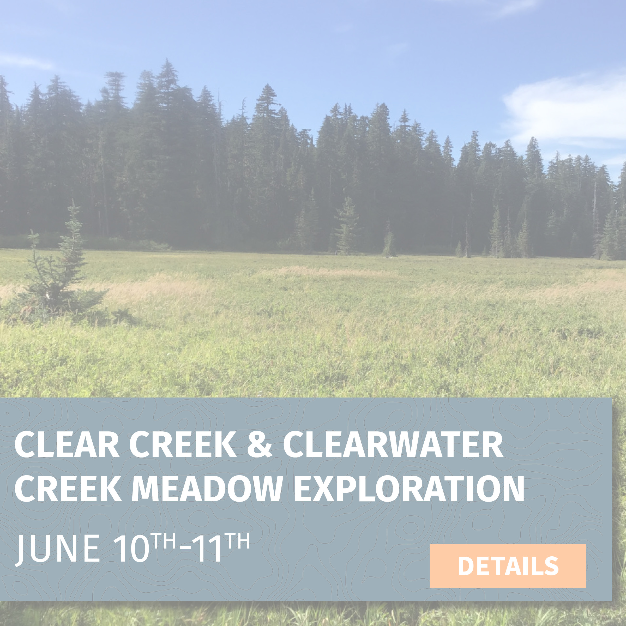
Clear Creek & Clearwater Creek Meadow Exploration
Project: Clear Creek & Clearwater Creek Meadow Exploration
Date: June 10-11, 2023 (10:00 am Saturday - 3:00 pm Sunday)
Location: East side of Mount St. Helens (2 hours from PDX/Vancouver)
Trip leader: Deb Goldberg
Trip description: Reed canary grass has become a particularly concerning invasive plant in many areas in our region, out-competing native species and altering ecosystems. Reed canary grass grows quickly and forms dense stands, blocking out sunlight, reducing plant diversity, and exacerbating drought issues.
On this trip, volunteers will learn how to identify invasive species, including reed canary grass. We will be working with the Forest Service to assess on-the-ground conditions to help design a long-term aquatic restoration project along tributaries of the Lewis River, Clear Creek, and Clearwater Creek. Employing the “early detection, rapid response” model, our goal is to document the presence and absence of invasive species in certain locations before they are able to get a strong footing. We will also be collecting information on stream conditions and beaver habitat to inform future restoration efforts.
Task: Survey the presence of invasive species and document stream conditions
Trip difficulty: 4 out of 5 || This trip entails walking in and around creeks and ponds, through brush and over uneven ground. Volunteers are encouraged to work at a comfortable pace.
What you need: Sturdy hiking boots, warm layers, rain gear, sun protection, day pack with food/water and other essentials, and camping gear (detailed list sent via email)
Gear provided: Data collection equipment
Lodging: Camping near Pine Creek Information Center

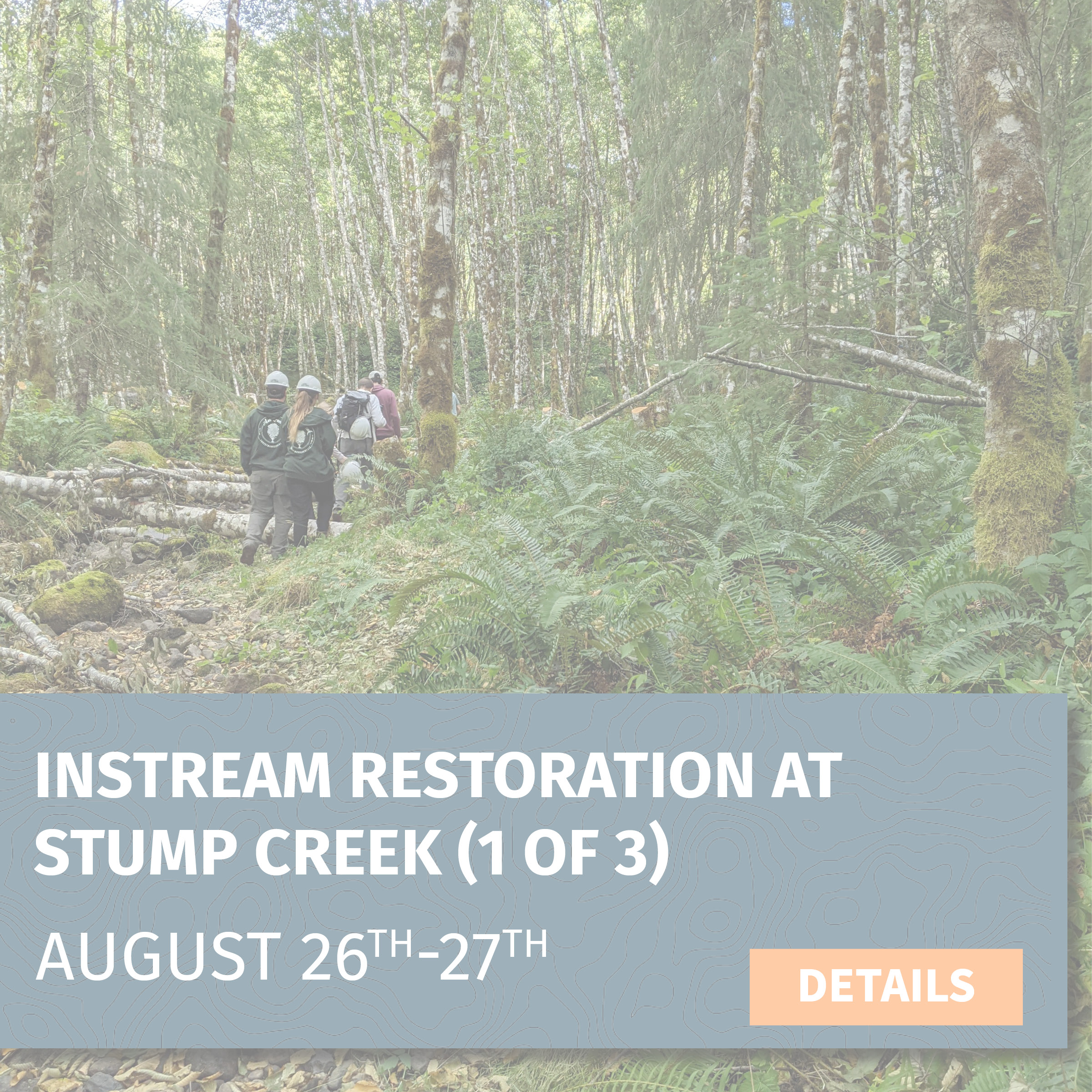
Instream Restoration at Stump Creek #1
Project: Instream Restoration at Stump Creek #1
Date: August 26-27, 2023 (10:00 am Saturday - 2:00 pm Sunday)
Location: Stump Creek, in the upper reaches of the South Fork Toutle River (2.5 hours from PDX/Vancouver)
Trip leader: Amanda Keasberry
Trip description: On this trip, we will be working to improve instream habitat along a waterway called Stump Creek, which flows into the South Fork Toutle River just west of Mount St. Helens. Volunteers will learn to use “low-tech restoration” techniques to build small instream wood structures using sustainably-sourced trees and branches. These structures will increase stream complexity, attenuate flows, and create deep pools—all of which are habitat improvements that will benefit salmonids and Pacific lamprey!
In addition to the direct benefits we hope to see, these kinds of projects are also intended to help beavers re-establish themselves in these landscapes by creating anchor points that will attract them and offer protection from predation (deep pools and new side-channels). This will help them establish local populations so that their presence can extend the positive aquatic impacts far into the future.
Task: Using handsaws, loppers, and clippers to gather natural material and then strategically placing them in the stream (during and before the placement of larger wood pieces)
Trip difficulty: 5 out of 5 || This trip entails full days of physical labor near and in creeks and ponds. Getting into shallow water will be required for this trip. Volunteers are encouraged to work at a comfortable pace.
What you need: Sturdy hiking boots, warm layers, rain gear, sun protection, day pack with food/water and other essentials, and camping gear (detailed list sent via email)
Gear provided: Hand tools, gloves, rubber boots, waders, safety glasses, hard hats
Lodging: Dispersed camping at project site
Timber Sale and Road Surveys - Little White Planning Area
Project: Timber Sale and Road Surveys - Little White Planning Area
Date: NEW DATES September 30 - October 1
Location: Little White Salmon River, near Willard, WA (1.5 hours from PDX/Vancouver)
Trip leader: Ashley Short
Trip description: The Little White planning area occupies a distinct transitional zone between wet westside forests and the drier stands found in the east side of the Cascades. Join our Policy Manager on this trip to learn about timber sales while collecting on-the-ground information about the forest stands that may be included in the Little White timber sale. The data collected on this trip will help CFC pinpoint habitat features and priority areas for protection, which will help us maximize the accuracy and impact of our advocacy efforts to ensure sustainable and climate-smart management in this area.
Task: Walking 2+ miles through forest areas and collecting data using diameter tapes, clinometers, and iPads
Trip difficulty: 4 out of 5 || The trip entails walking over downed logs, through thick brush, and on uneven and sometimes steep terrain.
What you need: Sturdy hiking boots, warm layers, rain gear, sun protection, day pack with food/water and other essentials, and camping gear (detailed list sent via email)
Gear provided: Data collection equipment
Lodging: Campground near Willard, WA

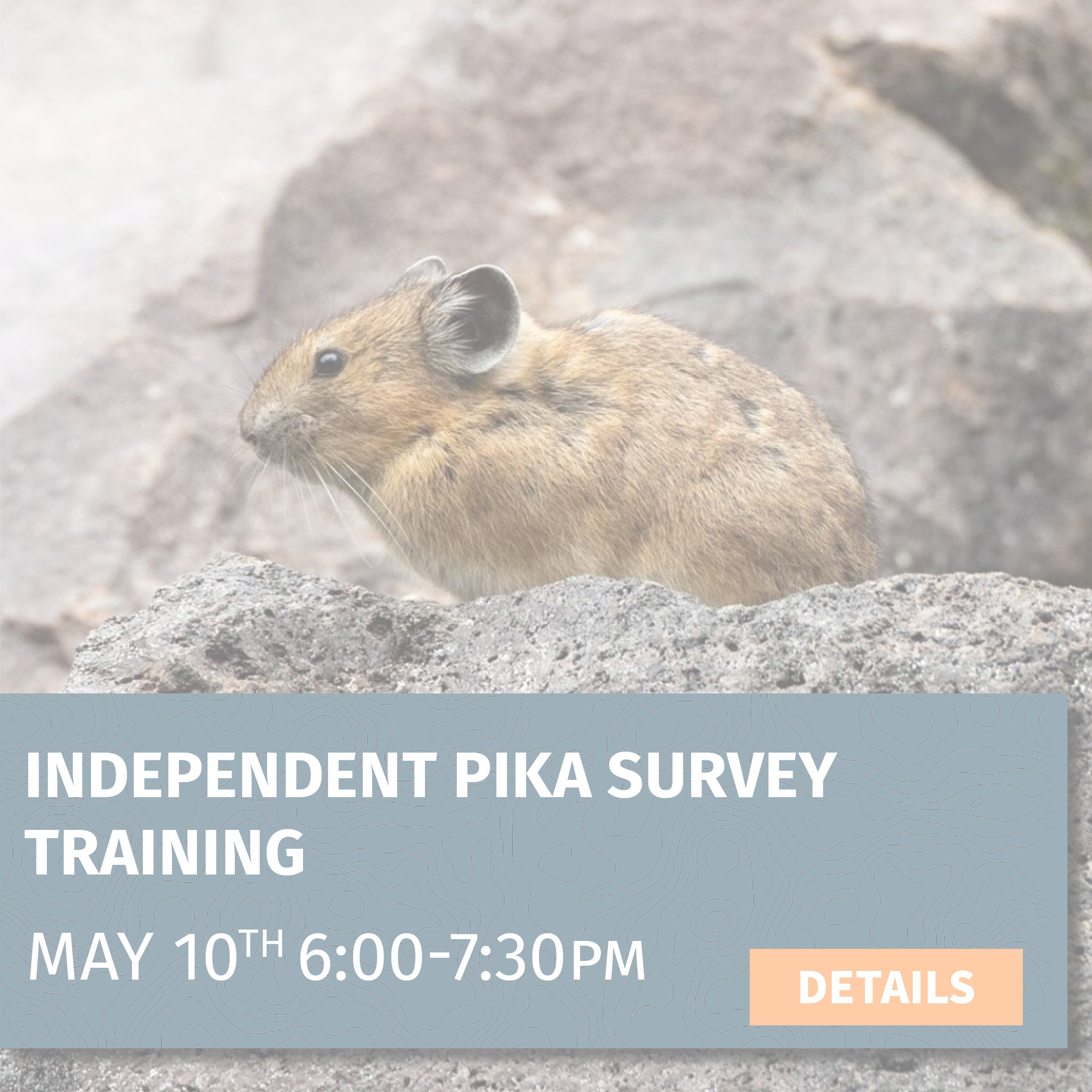
Independent Pika Survey Training
Project: Independent Pika Survey Training
Date: May 10, 2023 @ 6:00 pm–7:30 pm
Location: Virtual
Training leader: Amanda Keasberry
Project description: Pika are sensitive to climate pressures, and many populations are in decline. CFC is aiding scientists studying pika populations in the North Cascades and the Columbia Gorge by filling in information gaps about populations in the southern Washington Cascades.
During this training, you will learn about pika and habitat identification, opportunistic observations vs. sitting surveys, equipment checklist, safety procedures, and volunteer guidelines. The surveys will be completed independently by volunteers on their own time.
This is the perfect opportunity for people who want to be involved in conservation projects in the Cascades but can’t join us for our weekend trips.
Trip difficulty: Surveys will involve as much hiking as you desire. Many locations will be near roads and will require more driving than hiking.
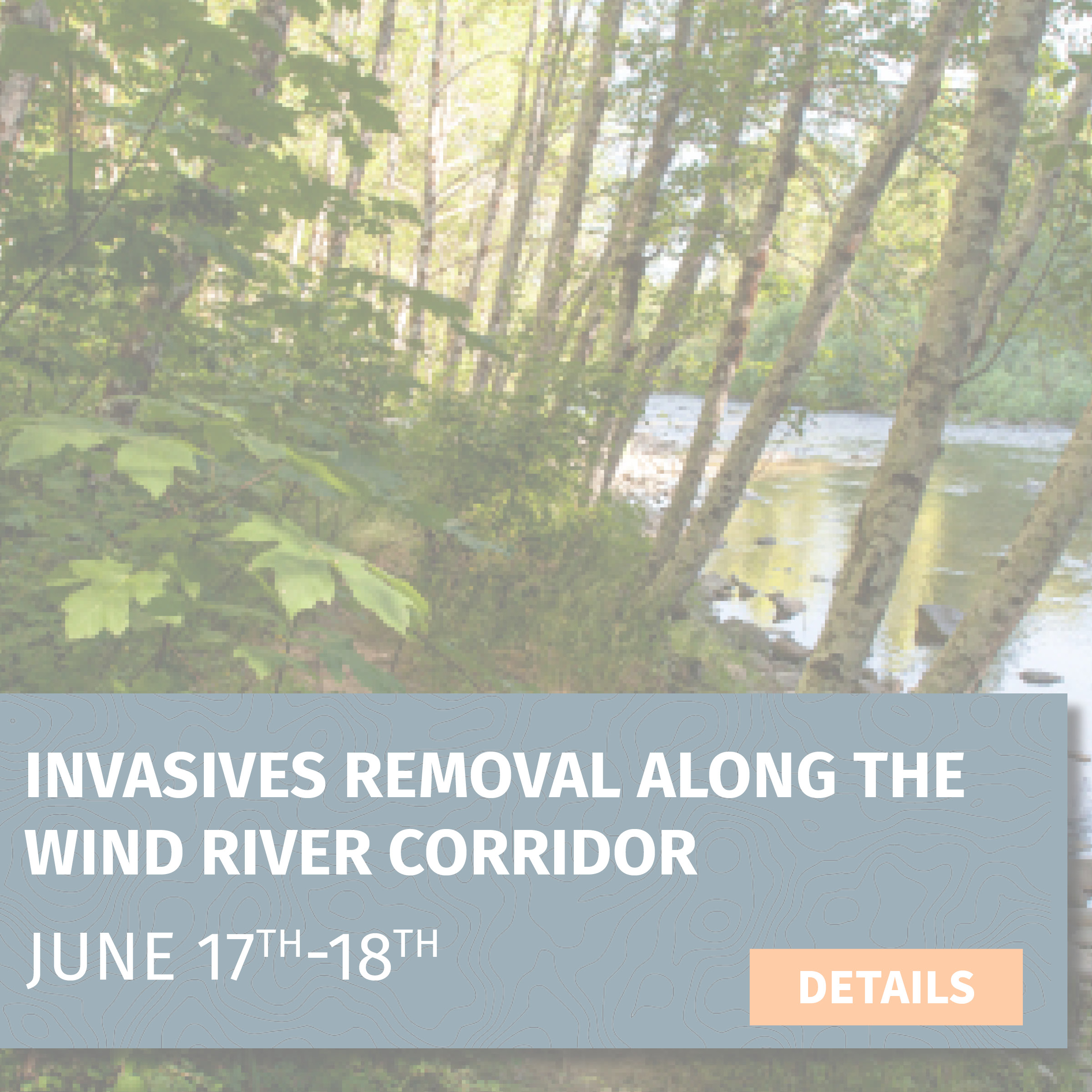
Invasives Removal along the Wind River Corridor
Project: Invasives Removal along the Wind River Corridor
Date: June 17-18, 2023 (10:00 am Saturday - 3:00 pm Sunday)
Location: Wind River near Trapper Creek (1.5 hours from PDX/Vancouver)
Trip leader: Deb Goldberg
Trip description: Locations of the invasive plant species herb Robert have been identified in several areas along the Wind River. Herb Robert’s tolerance to shady understories and its threat to mature forest ecosystems make it an invasive species of particular concern to CFC.
Join us on this two-day trip to various campgrounds, trails, and forest habitats along the Wind River. In addition to removing herb Robert, you will also be helping to map the area using GIS. This will help CFC and the Forest Service monitor future locations to ensure the plants haven’t reinvaded the area.
Task: Hand-pulling invasive species along a trail and mapping removal locations on an iPad
Trip difficulty: 3 out of 5 || This trip will entail going off-trail and potentially walking over downed logs and through brush. This activity also requires a lot of continual bending and squatting.
What you need: Sturdy hiking boots, warm layers, rain gear, sun protection, day pack with food/water and other essentials, and camping gear (detailed list sent via email)
Gear provided: Gloves, trash bags
Lodging: Developed campground near the Wind River
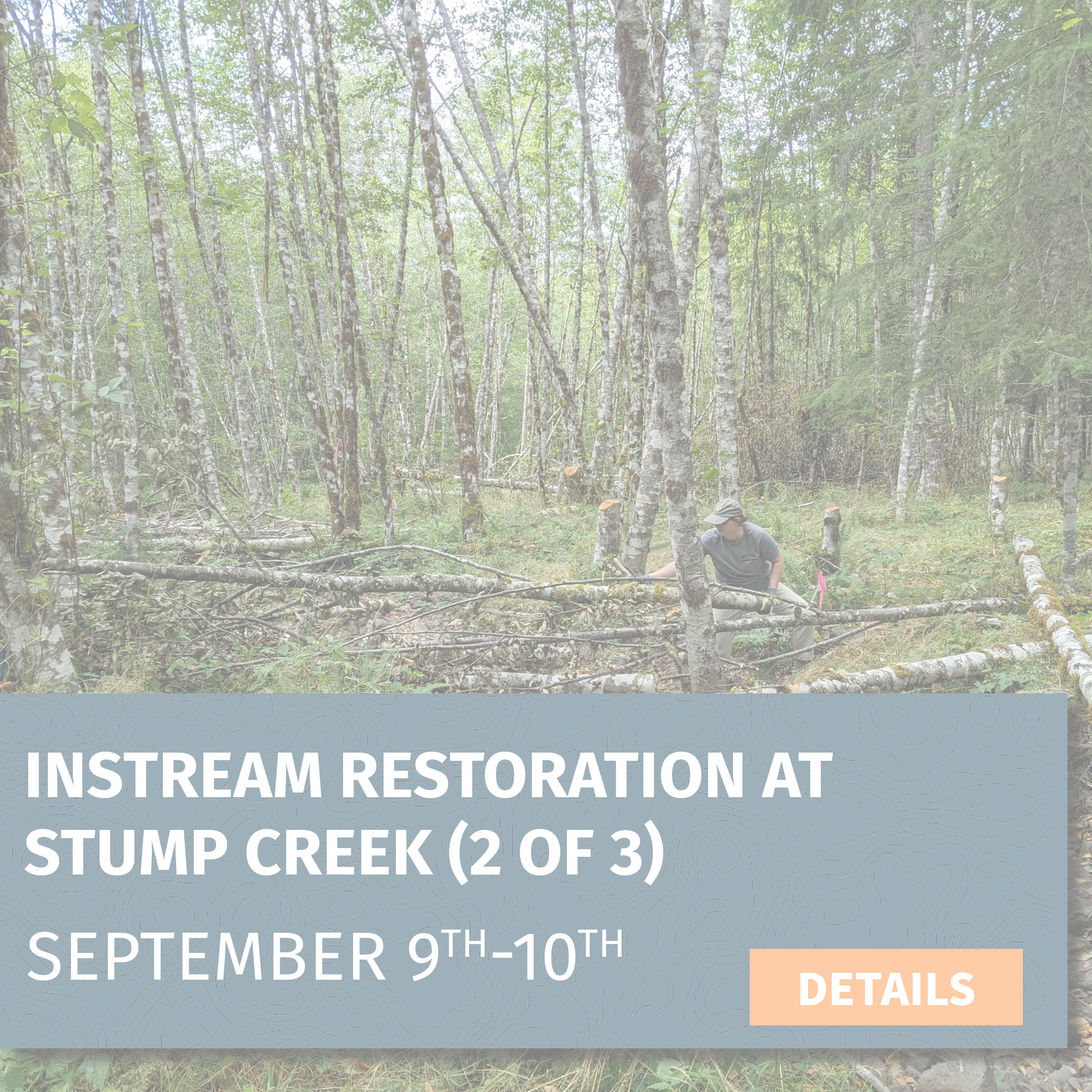
Instream Restoration at Stump Creek #2
Project: Instream Restoration at Stump Creek #2
Date: September 9–10, 2023 (10:00 am Saturday - 2:00 pm Sunday)
Location: Stump Creek, in the upper reaches of the South Fork Toutle River (2.5 hours from PDX/Vancouver)
Trip leader: Amanda Keasberry
Trip description: Trip description: On this trip, we will be working to improve instream habitat along a waterway called Stump Creek, which flows into the South Fork Toutle River just west of Mount St. Helens. Volunteers will learn to use “low-tech restoration” techniques to build small instream wood structures using sustainably-sourced trees and branches. These structures will increase stream complexity, attenuate flows, and create deep pools—all of which are habitat improvements that will benefit salmonids and Pacific lamprey!
In addition to the direct benefits we hope to see, these kinds of projects are also intended to help beavers re-establish themselves in these landscapes by creating anchor points that will attract them and offer protection from predation (deep pools and new side-channels). This will help them establish local populations so that their presence can extend the positive aquatic impacts far into the future.
Task: Using handsaws, loppers, and clippers to gather natural material and then strategically placing them in the stream (during and before the placement of larger wood pieces)
Trip difficulty: 5 out of 5 || This trip entails full days of physical labor near and in creeks and ponds. Getting into shallow water will be required for this trip. Volunteers are encouraged to work at a comfortable pace
What you need: Sturdy hiking boots, warm layers, rain gear, sun protection, day pack with food/water and other essentials, and camping gear (detailed list sent via email)
Gear provided: Hand tools, gloves, rubber boots, waders, safety glasses, hard hats
Lodging:Dispersed camping at project site
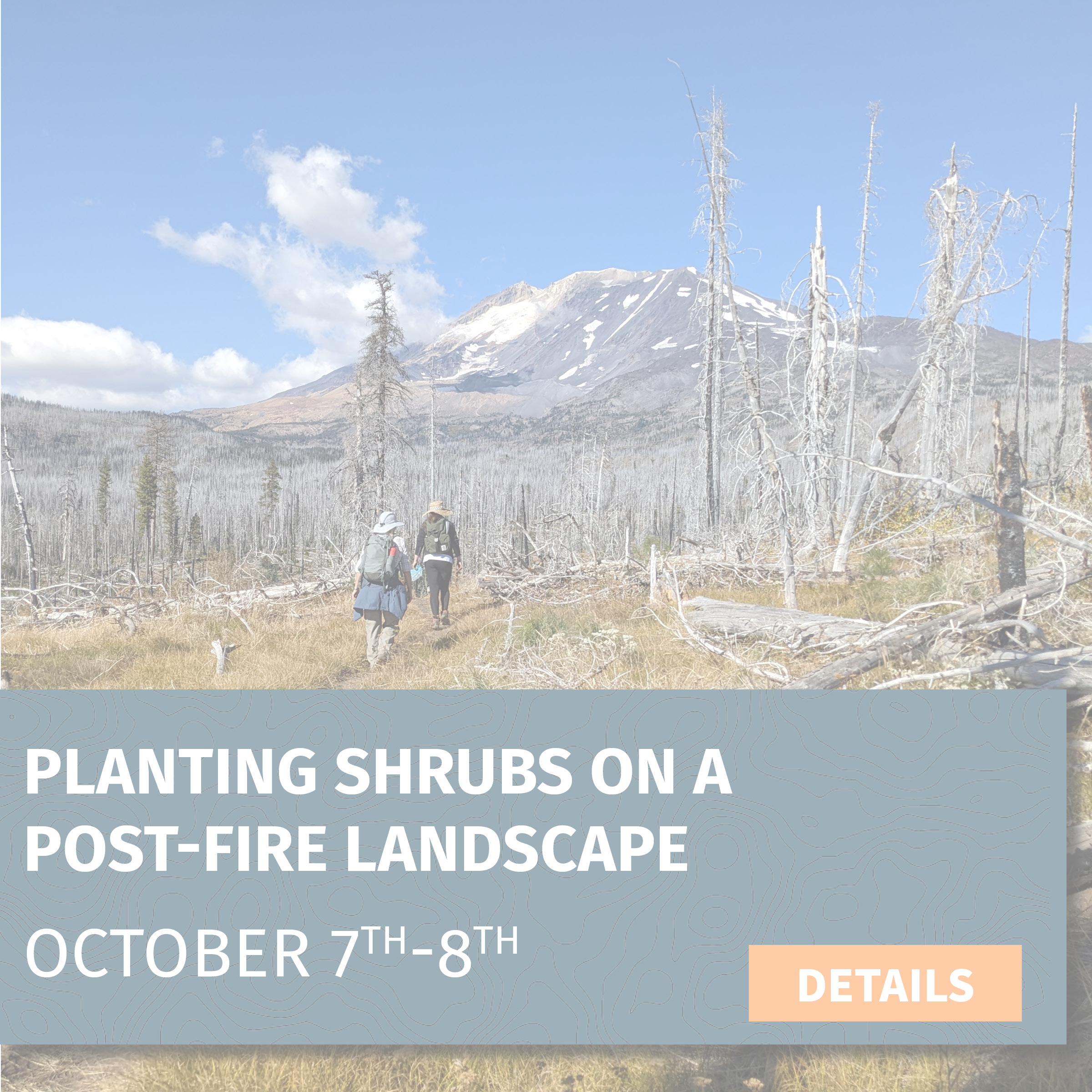
Planting Shrubs on a Post-fire Landscape
Project: Planting Shrubs on a Post-fire Landscape
Date: October 7-8, 2023 (Saturday 10:00am-4:00pm)
Location: South of Mount Adams (2 hours from PDX/Vancouver)
Trip leader: Deb Goldberg
Trip description: The high-elevation forests on the southern slopes of Mount Adams were, historically, well-adapted to wildfires. However, a series of unusually severe, or short-interval fires (fires that repeatedly impact the same area at a higher frequency than is typical) can deplete an area’s natural seed bank and slow or even prevent normal post-fire regenerative processes. CFC and volunteers have been working to increase the biodiversity and resilience of fire-impacted habitats around Mount Adams by dispersing native seeds and planting native shrubs.
This year we will be planting more volunteer-collected shrub species and checking on the success of our seeding and planting efforts from previous years. We will be hiking back to our planting locations along the Cold Springs trail. We have over 2500 shrubs to plant, so we’ll need as many hands as we can get!
Task: Hike 3+ miles on and off-trail with planting bags filled with shrubs (~20 lb pack) and planting around ~100 shrubs per day, per person
Trip difficulty: 5 out of 5 || This trip entails walking on and off-trail and continuous bending and squatting while planting. There are many downed logs and uneven ground in the area
What you need: Sturdy hiking boots, warm layers, rain gear, sun protection, day pack with food/water and other essentials, and camping gear (detailed list sent via email)
Gear provided: Shovels, planting bags, gloves
Lodging: Developed campground near Trout Lake
Willow Harvesting for Oregon Spotted Frog Habitat
Project: Willow Harvesting for Oregon Spotted Frog Habitat
Date: April 1 (Saturday, 10:00 am-4:00 pm)
Location: Trout Lake Creek, WA (2 hours from PDX/Vancouver)
Trip leader: Amanda Keasberry
Trip description: We'll be harvesting 1,500 dormant willow stems that will later be planted in a habitat complex for the Oregon spotted frog that the U.S. Forest Service has been working to restore for several years. The Oregon spotted frog is listed under the Endangered Species Act as threatened, and the population at this project site is one of few in the state.
Botany specialists from the Forest Service will be present to provide background information on the frog's life history and our shared conservation goals. The stems we collect will be moved to a Forest Service cooler so they can maintain their dormancy until we can plant them once the snow melts enough for us to be able to access the planting site.
Task: Cutting willow stems with loppers and clippers
Trip difficulty: 3 out of 5 || This trip includes using hand tools, continual bending and squatting and walking on uneven terrain with heavy gear. Volunteers are encouraged to work at a pace that is most comfortable for them.
What you need: Sturdy hiking boots, warm layers, rain gear, sun protection, day pack with food/water and other essentials, and camping gear (detailed list sent via email)
Gear provided: Rubber boots, waders, loppers, clippers, gloves
Planting Willows To Improve Oregon Spotted Frog Habitat
Project: Planting Willows To Improve Oregon Spotted Frog Habitat
Date: April 15 (Saturday, 10:00 am-4:00 pm)
Location: Trout Lake Creek, near Trout Lake, WA (2 hours from PDX/Vancouver)
Trip leader: Amanda Keasberry
Trip description: We'll be planting the 1,500 willow stems that were harvested earlier in the month into a habitat complex that the U.S. Forest Service has been working to restore habitat for the Oregon spotted frog, a species listed as threatened under the Endangered Species Act. Botany specialists from the Forest Service will be present to provide background information on the species' life history and conservation goals. We will focus on reinforcing a beaver dam analog that was built to help hold water in the system for longer periods. We will also be planting in adjacent areas to enhance the overall biodiversity of this wetland habitat.
Task: Staking willows in wetland habitat.
Trip difficulty: 3 out of 5 || This trip includes continual bending, squatting, and walking on uneven terrain with heavy gear. Volunteers are encouraged to work at a pace that is most comfortable for them.
What you need: Sturdy hiking boots, warm layers, rain gear, sun protection, day pack with food/water and other essentials, and camping gear (detailed list sent via email)
Gear provided: Rubber boots, gloves, planting bags
Amphibian Egg Mass Surveys at Future Restoration Site
Project: Amphibian Egg Mass Surveys at Future Restoration Site
Date: April 22-23, 2023 (Saturday - Sunday)
Location: Tributaries of the Cispus River, near Randle, WA (2.5 hours from PDX/Vancouver)
Training leader: Amanda Keasberry
Project description:
Amphibians rely on both aquatic and terrestrial landscapes to breed and live. Instream restoration has the potential to benefit amphibian populations, and we are setting out to collect field data to help answer questions about the role that our restoration projects can play in improving the health and resilience of amphibians. We will be visiting the sites of future aquatic restoration projects where woody debris will be added to the water to create habitat complexity. This addition of wood should keep water in the system for longer, create deeper pools, and form new side channels and wetlands, all of which are changes that can make new habitat for frog and salamander species. We will survey several project sites for egg masses to see what amphibian species are breeding in these areas. After the restoration project is complete in the following years, we will revisit the site to see how amphibians responded to the work. A WSU graduate student will be joining us to teach us amphibian identification and methods for conducting egg mass surveys. This will be an enjoyable learning experience for all!
Task: Searching streams and wetland areas for frogs and salamanders
Trip difficulty: 4 out of 5 || This trip entails walking in and around creeks and ponds. Getting into shallow water will be required for this trip. Volunteers are encouraged to work at a comfortable pace.
What you need: Sturdy hiking boots (rubber boots if you have them), warm layers, rain gear, sun protection, day pack with food/water and other essentials, and camping gear (detailed list sent via email)
Gear provided: Rubber boots, waders, data collection equipment
Lodging: Bunkhouses
Independent Pika Survey Training
Project: Independent Pika Survey Training
Date: May 10, 2023 @ 6:00 pm–7:30 pm
Location: Virtual
Training leader: Amanda Keasberry
Project description: Pika are sensitive to climate pressures, and many populations are in decline. CFC is aiding scientists studying pika populations in the North Cascades and the Columbia Gorge by filling in information gaps about populations in the southern Washington Cascades.
During this training, you will learn about pika and habitat identification, opportunistic observations vs. sitting surveys, equipment checklist, safety procedures, and volunteer guidelines. The surveys will be completed independently by volunteers on their own time.
This is the perfect opportunity for people who want to be involved in conservation projects in the Cascades but can’t join us for our weekend trips.
Trip difficulty: Surveys will involve as much hiking as you desire. Many locations will be near roads and will require more driving than hiking.
Independent Western Redcedar Dieback Study Training
Project: Independent Western Redcedar Dieback Study Training
Date: May 20, 2023 10:00am–12:00pm
Location: Mt. Tabor, Portland, OR
Training leader: Amanda Keasberry
Project description: Western redcedar is critical to the livelihood of our forests and communities. However, many reports of dieback have been documented recently. Washington State University and Oregon State University researchers urgently need help understanding why! They have launched a community science project to try to collect as much data as possible to understand what is causing western redcedar dieback. There is a lack of data about western redcedars in SW Washington, so we will be providing materials and training to empower our volunteers to help these iconic trees by collecting data for this project while enjoying the beautiful southern Washington Cascades.
During this training, you will learn about western redcedar identification and ecology, equipment checklist, safety procedures, and volunteer guidelines. The surveys will be completed independently by volunteers on their own time.
This is the perfect opportunity for people who want to be involved in conservation projects in the Cascades but can’t join us for our weekend trips.
Trip difficulty: Surveys will involve as much hiking as you desire.
Invasives Mapping and Removal in Old-Growth Forests
Project: Invasives Mapping and Removal in Old-Growth Forests
Date: June 3-4, 2023 (10:00 am Saturday - 3:00 pm Sunday)
Location: Lewis River Trail near Curly Creek Falls, (2 hours from PDX/Vancouver)
Trip leader: Suzanne Whitney
Trip description: Locations of the invasive plant species herb Robert have been identified in stands of old-growth along the Lewis River. Herb Robert’s tolerance to shady understories and its threat to mature forest ecosystems make it an invasive species of particular concern to CFC.
Join us on this two-day trip where we will visit a few areas of old-growth forest in and around the Lewis River valley. In addition to removing herb Robert, you will also be helping to map the area using GIS. This will help CFC and the Forest Service monitor future locations to ensure the plants haven’t reinvaded the area.
Task: Hand-pulling invasive species along a trail and mapping removal locations on an iPad.
Trip difficulty: 3 out of 5 || This trip will entail walking 3+ miles on a trail that is rated moderate. On occasion, you will be going off-trail and potentially walking over downed logs and through brush. This activity also requires a lot of continual bending and squatting.
What you need: Sturdy hiking boots, warm layers, rain gear, sun protection, day pack with food/water and other essentials, and camping gear (detailed list sent via email)
Gear provided: Gloves, trash bags
Lodging: Developed campground near the Lewis River
Clear Creek & Clearwater Creek Meadow Exploration
Project: Clear Creek & Clearwater Creek Meadow Exploration
Date: June 10-11, 2023 (10:00 am Saturday - 3:00 pm Sunday)
Location: East side of Mount St. Helens (2 hours from PDX/Vancouver)
Trip leader: Deb Goldberg
Trip description: Reed canary grass has become a particularly concerning invasive plant in many areas in our region, out-competing native species and altering ecosystems. Reed canary grass grows quickly and forms dense stands, blocking out sunlight, reducing plant diversity, and exacerbating drought issues.
On this trip, volunteers will learn how to identify invasive species, including reed canary grass. We will be working with the Forest Service to assess on-the-ground conditions to help design a long-term aquatic restoration project along tributaries of the Lewis River, Clear Creek, and Clearwater Creek. Employing the “early detection, rapid response” model, our goal is to document the presence and absence of invasive species in certain locations before they are able to get a strong footing. We will also be collecting information on stream conditions and beaver habitat to inform future restoration efforts.
Task: Survey the presence of invasive species and document stream conditions
Trip difficulty: 4 out of 5 || This trip entails walking in and around creeks and ponds, through brush and over uneven ground. Volunteers are encouraged to work at a comfortable pace.
What you need: Sturdy hiking boots, warm layers, rain gear, sun protection, day pack with food/water and other essentials, and camping gear (detailed list sent via email)
Gear provided: Data collection equipment
Lodging: Camping near Pine Creek Information Center
Invasives Removal along the Wind River Corridor
Project: Invasives Removal along the Wind River Corridor
Date: June 17-18, 2023 (10:00 am Saturday - 3:00 pm Sunday)
Location: Wind River near Trapper Creek (1.5 hours from PDX/Vancouver)
Trip leader: Deb Goldberg
Trip description: Locations of the invasive plant species herb Robert have been identified in several areas along the Wind River. Herb Robert’s tolerance to shady understories and its threat to mature forest ecosystems make it an invasive species of particular concern to CFC.
Join us on this two-day trip to various campgrounds, trails, and forest habitats along the Wind River. In addition to removing herb Robert, you will also be helping to map the area using GIS. This will help CFC and the Forest Service monitor future locations to ensure the plants haven’t reinvaded the area.
Task: Hand-pulling invasive species along a trail and mapping removal locations on an iPad
Trip difficulty: 3 out of 5 || This trip will entail going off-trail and potentially walking over downed logs and through brush. This activity also requires a lot of continual bending and squatting.
What you need: Sturdy hiking boots, warm layers, rain gear, sun protection, day pack with food/water and other essentials, and camping gear (detailed list sent via email)
Gear provided: Gloves, trash bags
Lodging: Developed campground near the Wind River
Huckleberry Monitoring & Picking
Project: Huckleberry Monitoring & Picking
Date: August 5-6, 2023 (10:00 am Saturday - 3:00 pm Sunday)
Location: Sawtooth Berry Fields (2 hours from PDX/Vancouver)
Trip leader: Deb Goldberg
Trip description: Through our involvement with the Pinchot Partners forest collaborative, we are continuing to monitor huckleberry sites to determine the effects of forest thinning on huckleberry growth. On the first day, volunteers will receive on-site training and will then split into groups to collect data either within forest stands that are set to be thinned for huckleberry restoration in the near future or at sites previously surveyed to collect follow-up data. On day two, we’ll return to the huckleberry fields to visit more plots before spending the remainder of the day picking huckleberries (participants must obtain a free Forest Products Permit). Join us to learn all about huckleberries and their cultural and ecological importance!
Task: Data collection and huckleberry picking
Trip difficulty: 4 out of 5 || This trip will entail hiking on uneven ground, through brush, and over downed logs. Trees are limited in this area, so there will be extended periods of sun exposure.
What you need: Sturdy hiking boots, warm layers, rain gear, sun protection, day pack with food/water and other essentials, camping gear (detailed list sent via email), huckleberry permit https://apps.fs.usda.gov/gp/#mainSection, gallon container for huckleberries
Gear provided: Data collection equipment
Lodging: Campground near Indian Heaven Wilderness
Native Seed Collection
Project: Native Seed Collection
Date: August 19, 2023 (Saturday 10:00am-4:00pm)
Location: Gifford Pinchot National Forest south of Mount Adams
Trip leader: Deb Goldberg
Trip description: Join us to collect native shrub and wildflower seeds that will contribute to our long-term effort to increase biodiversity in the post-fire habitats around Mount Adams. The seeds will be used for restoration in forest stands severely impacted by uncharacteristically intense and recurrent fires. Volunteers will be trained by a U.S. Forest Service botany specialist on the identification and benefits of various native species. Some of the seeds we collect on this trip will be sown directly on the burned landscape this fall, while others will be sent to a Forest Service facility to be grown out for planting in the future. Help us gather seeds while also learning to identify over 20 native plants found in the Gifford Pinchot National Forest!
Task: Learning native plant identification and collecting seeds
Trip difficulty: 2 out of 5 || The trip requires walking along uneven ground and extended exposure to the sun. This activity also requires a lot of continual bending and squatting
What you need: Sturdy hiking boots, warm layers, rain gear, sun protection, day pack for food/water and other essentials
Gear provided: Gloves, bags for gathering seed
Instream Restoration at Stump Creek #1
Project: Instream Restoration at Stump Creek #1
Date: August 26-27, 2023 (10:00 am Saturday - 2:00 pm Sunday)
Location: Stump Creek, in the upper reaches of the South Fork Toutle River (2.5 hours from PDX/Vancouver)
Trip leader: Amanda Keasberry
Trip description: On this trip, we will be working to improve instream habitat along a waterway called Stump Creek, which flows into the South Fork Toutle River just west of Mount St. Helens. Volunteers will learn to use “low-tech restoration” techniques to build small instream wood structures using sustainably-sourced trees and branches. These structures will increase stream complexity, attenuate flows, and create deep pools—all of which are habitat improvements that will benefit salmonids and Pacific lamprey!
In addition to the direct benefits we hope to see, these kinds of projects are also intended to help beavers re-establish themselves in these landscapes by creating anchor points that will attract them and offer protection from predation (deep pools and new side-channels). This will help them establish local populations so that their presence can extend the positive aquatic impacts far into the future.
Task: Using handsaws, loppers, and clippers to gather natural material and then strategically placing them in the stream (during and before the placement of larger wood pieces)
Trip difficulty: 5 out of 5 || This trip entails full days of physical labor near and in creeks and ponds. Getting into shallow water will be required for this trip. Volunteers are encouraged to work at a comfortable pace.
What you need: Sturdy hiking boots, warm layers, rain gear, sun protection, day pack with food/water and other essentials, and camping gear (detailed list sent via email)
Gear provided: Hand tools, gloves, rubber boots, waders, safety glasses, hard hats
Lodging: Dispersed camping at project site
Instream Restoration at Stump Creek #3
Project: Instream Restoration at Stump Creek #3
Date: September 23-24, 2023 (10:00 am Saturday - 2:00 pm Sunday)
Location: Stump Creek, in the upper reaches of the South Fork Toutle River (2.5 hours from PDX/Vancouver)
Trip leader: Shiloh Halsey
Trip description: Trip description: On this trip, we will be working to improve instream habitat along a waterway called Stump Creek, which flows into the South Fork Toutle River just west of Mount St. Helens. Volunteers will learn to use “low-tech restoration” techniques to build small instream wood structures using sustainably-sourced trees and branches. These structures will increase stream complexity, attenuate flows, and create deep pools—all of which are habitat improvements that will benefit salmonids and Pacific lamprey!
In addition to the direct benefits we hope to see, these kinds of projects are also intended to help beavers re-establish themselves in these landscapes by creating anchor points that will attract them and offer protection from predation (deep pools and new side-channels). This will help them establish local populations so that their presence can extend the positive aquatic impacts far into the future.
Task: Using handsaws, loppers, and clippers to gather natural material and then strategically placing them in the stream (during and before the placement of larger wood pieces)
Trip difficulty: 5 out of 5 || This trip entails full days of physical labor near and in creeks and ponds. Getting into shallow water will be required for this trip. Volunteers are encouraged to work at a comfortable pace
What you need: Sturdy hiking boots, warm layers, rain gear, sun protection, day pack with food/water and other essentials, and camping gear (detailed list sent via email)
Gear provided: Hand tools, gloves, rubber boots, waders, safety glasses, hard hats
Lodging: Dispersed camping at project site
Green River Trail Hike
Project: Hiking the Green River Trail
Date: September 23, 2023 (Saturday 10:00am-4:00pm)
Location: Meet at the Cowlitz Valley Ranger Station (2 hours from PDX/Vancouver)
Trip leader: Sean Roome & Ashley Short
Trip description: We will be hiking the first 3 miles (6 miles total including the return trip) of the Green River Trail, which is a fairly flat and easy walk through the Green River Valley along the beautiful Green River. Once we get to the trailhead, we will start our trip with a short introduction and history of our efforts to prevent a mine in this site, and then make our way down the trail. At the turnaround point, we will have lunch and chat about our campaign to protect this place in perpetuity before making our way back to the trailhead.
Task: Hike 4 miles along the Green River Trail in the Gifford Pinchot National Forest
Trip difficulty: 2 out of 5 || This trip entails walking on trail over relatively flat ground.
What you need: Sturdy hiking boots, warm layers, rain gear, sun protection, day pack with food/water and other essentials (detailed list sent via email)
Gear provided: N/A
Lodging: N/A
Timber Sale and Road Surveys - Little White Planning Area
Project: Timber Sale and Road Surveys - Little White Planning Area
Date: NEW DATES September 30 - October 1
Location: Little White Salmon River, near Willard, WA (1.5 hours from PDX/Vancouver)
Trip leader: Ashley Short
Trip description: The Little White planning area occupies a distinct transitional zone between wet westside forests and the drier stands found in the east side of the Cascades. Join our Policy Manager on this trip to learn about timber sales while collecting on-the-ground information about the forest stands that may be included in the Little White timber sale. The data collected on this trip will help CFC pinpoint habitat features and priority areas for protection, which will help us maximize the accuracy and impact of our advocacy efforts to ensure sustainable and climate-smart management in this area.
Task: Walking 2+ miles through forest areas and collecting data using diameter tapes, clinometers, and iPads
Trip difficulty: 4 out of 5 || The trip entails walking over downed logs, through thick brush, and on uneven and sometimes steep terrain.
What you need: Sturdy hiking boots, warm layers, rain gear, sun protection, day pack with food/water and other essentials, and camping gear (detailed list sent via email)
Gear provided: Data collection equipment
Lodging: Campground near Willard, WA
Planting Shrubs on a Post-fire Landscape
Project: Planting Shrubs on a Post-fire Landscape
Date: October 7-8, 2023 (Saturday 10:00am-4:00pm)
Location: South of Mount Adams (2 hours from PDX/Vancouver)
Trip leader: Deb Goldberg
Trip description: The high-elevation forests on the southern slopes of Mount Adams were, historically, well-adapted to wildfires. However, a series of unusually severe, or short-interval fires (fires that repeatedly impact the same area at a higher frequency than is typical) can deplete an area’s natural seed bank and slow or even prevent normal post-fire regenerative processes. CFC and volunteers have been working to increase the biodiversity and resilience of fire-impacted habitats around Mount Adams by dispersing native seeds and planting native shrubs.
This year we will be planting more volunteer-collected shrub species and checking on the success of our seeding and planting efforts from previous years. We will be hiking back to our planting locations along the Cold Springs trail. We have over 2500 shrubs to plant, so we’ll need as many hands as we can get!
Task: Hike 3+ miles on and off-trail with planting bags filled with shrubs (~20 lb pack) and planting around ~100 shrubs per day, per person
Trip difficulty: 5 out of 5 || This trip entails walking on and off-trail and continuous bending and squatting while planting. There are many downed logs and uneven ground in the area
What you need: Sturdy hiking boots, warm layers, rain gear, sun protection, day pack with food/water and other essentials, and camping gear (detailed list sent via email)
Gear provided: Shovels, planting bags, gloves
Lodging: Developed campground near Trout Lake
Instream Restoration at Stump Creek #2
Project: Riparian Planting at Cispus River
Date: November 11–12, 2023 (10:30 am Saturday - 3:00 pm Sunday)
Location: Cispus River/Yellowjacket Creek confluence (2.5 hours from PDX/Vancouver)
Trip leader: Amanda Keasberry
Trip description: We’ve planted over 7,000 Douglas firs and western redcedars at the Cispus/Yellowjacket inseam restoration site. To enhance biodiversity in the areas we already planted, we want to fill the area with willow and cottonwood. Conveniently, cottonwood and willow branches can be cut and placed stakes straight into the ground. For this trip, we will harvest cottonwood and willow on-site using loppers and clippers. This project is in partnership with Cowlitz Indian Tribe and the Forest Service, and the overall goals are to restore and improve the habitat for juvenile coho, winter steelhead, and spring Chinook salmon at the confluence of the Cispus River and Yellowjacket Creek.
Task: Using loppers and clippers to harvest cottonwood and willow and then staking them into the ground
Trip difficulty:4 out of 5 || Must be comfortable wading through streams ranging from ankle- to waist-deep. Walking to the project site involves walking over uneven terrain, including large cobbles.
What you need: Waders, warm layers, rain gear, sun protection, day pack with food/water and other essentials (detailed list sent via email)
Gear provided: Gloves, orange vests, loppers and clippers
Lodging: Cispus Learning Center